2026 · Phase 1Start here
$100K
Pilot year
Local Organisation Capacity Building
Program Manager, Finance & Administration Manager and Facility Coordinator in post; new OCA policies and systems tested on the ground.
Budget lines (1)
- 4.4.5 Administration and staffing — pilot year (part)PGK 445,000
2026 · Phase 1
$222K
Gazettal pathway & declaration
Conservation & Biodiversity
Submissions from the LLG Council to the Governor-General, ending in declaration of the Conservation Area over the 168,000 hectares under consent.
Budget lines (11)
- 1.1.10 Submission to Karimui LLG CouncilPGK 40,000
- 1.1.11 Submission to Karimui-Salt Nomane DDA / KSPDAPGK 40,000
- 1.1.12 Submission to KSN JDBPPCPGK 50,000
- 1.1.13 Submission to Simbu Provincial Management TeamPGK 60,000
- 1.1.14 Simbu Provincial Executive CouncilPGK 70,000
- 1.1.15 Submission to CEPAPGK 80,000
- 1.1.16 National Conservation CouncilPGK 100,000
- 1.1.17 National Executive CouncilPGK 120,000
- 1.1.18 90-day public notice in local mediaPGK 50,000
- 1.1.19 Submission to the Governor-GeneralPGK 80,000
- 1.1.20 Declaration of the Conservation AreaPGK 300,000
2026–27 · Phase 1
$225K
Environmental Impact Assessment
Conservation & Biodiversity
EIA, environmental and social studies across the proposed area.
Budget lines (1)
- 1.1.22 Environmental Impact Assessments (EIA / ES / EV)PGK 1,000,000
2027 · Phase 1
$315K
Land, clans & boundary mapping
Conservation & Biodiversity
Customary land investigated, clan histories recorded, Incorporated Land Groups formed and internal and external boundaries mapped.
Budget lines (9)
- 1.1.1 IUCN Red List species documentationPGK 200,000
- 1.1.2 Genealogy and history of clans and tribesPGK 300,000
- 1.1.3 Customary land investigation reportsPGK 90,000
- 1.1.4 Land valuation and site inspectionPGK 130,000
- 1.1.5 Customary land boundary mappingPGK 250,000
- 1.1.6 Land-use planning of the protected areaPGK 100,000
- 1.1.7 Incorporated Land GroupsPGK 150,000
- 1.1.8 External land boundary mappingPGK 100,000
- 1.1.9 Internal land boundary mappingPGK 80,000
2027 · Phase 1
$116K
Consent in the remaining wards
Conservation & Biodiversity
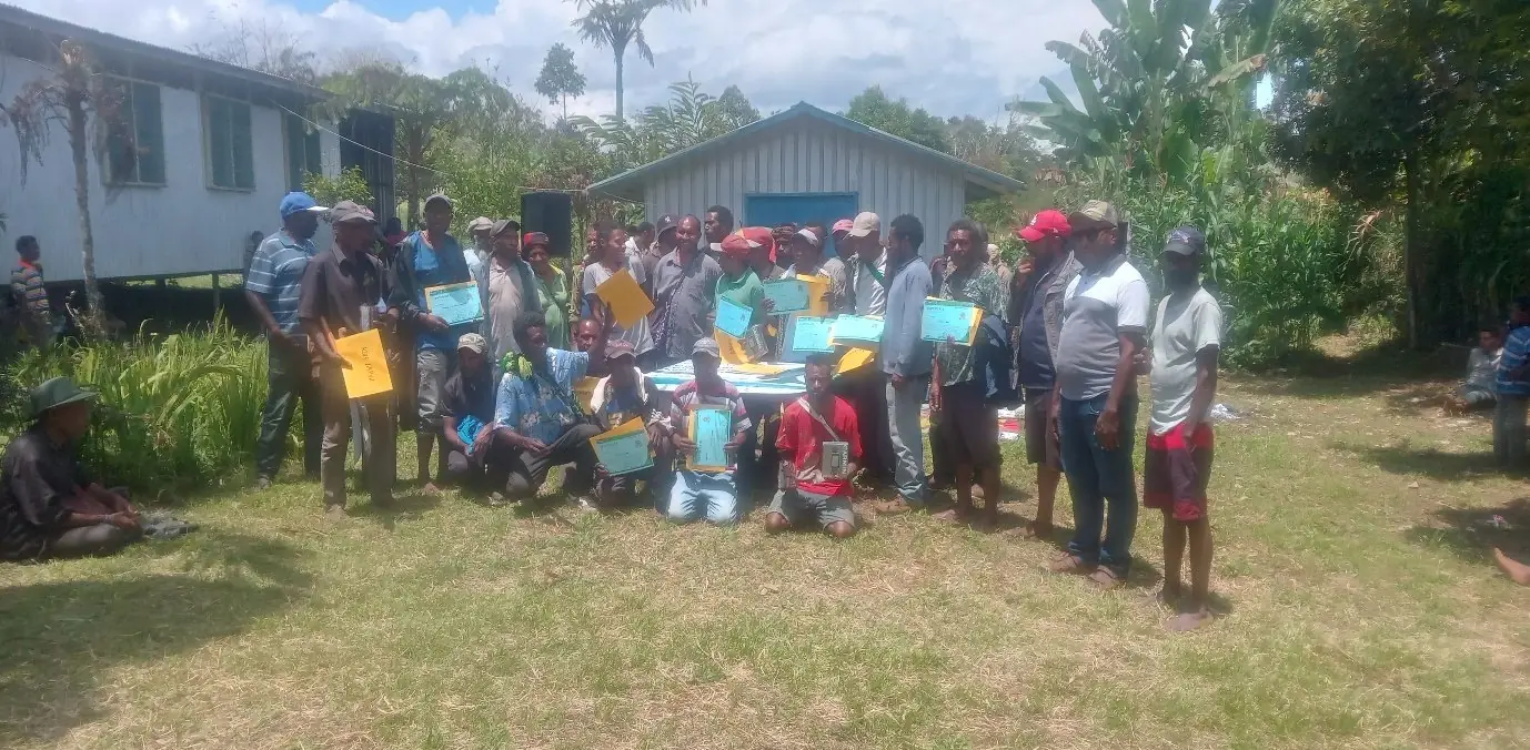
Community entry and awareness in the unsigned wards, extending FPIC toward the 302,000-hectare target (Ward 27 excluded).
Budget lines (6)
- 2.2.1 Workshops with community leadersPGK 75,000
- 2.2.2 Presentations by PWM, IBR, WCS, FRIPGK 80,000
- 2.2.3 Provincial Management Team presentationPGK 60,000
- 2.2.4 Presentations to local clan leadersPGK 80,000
- 2.2.5 Community awareness in new wardsPGK 100,000
- 2.2.6 Community Entry ProcessPGK 120,000
2027–30 · Phase 2
$237K
Core operations, Years 2–5
Local Organisation Capacity Building
Staffing, Board, audit and running costs that keep the organisation working through the Plan.
Budget lines (1)
- 4.4.5 Administration and staffing — Years 2–5 (balance)PGK 1,055,002
2028 · Phase 2
$157K
Management plan & rangers
Conservation & Biodiversity
CEPA-endorsed management plan, Conservation Area rules, a ranger station, and rangers recruited and trained.
Budget lines (5)
- 1.1.21 Conservation Area Management PlanPGK 150,000
- 4.4.1 Ranger stationPGK 150,000
- 4.4.2 Conservation Area rulesPGK 150,000
- 4.4.3 Recruitment of rangersPGK 100,000
- 4.4.4 Ranger workshops and trainingPGK 150,000
2028 · Phase 2
$112K
Biomass & ecosystem survey
Conservation & Biodiversity
Carbon biomass and ecosystem surveys — the basis for the REDD+ feasibility study.
Budget lines (1)
- 1.1.23 Biomass assessments and ecosystem surveyPGK 500,000
2028–29 · Phase 2
$202K
Livelihood enterprises
Sustainable Livelihoods
Coffee, honey, fish, poultry, piggery and nurseries through the Farmers' Cooperative — toward 5,000+ households with improved livelihoods.
Budget lines (6)
- 3.3.1 Fish farmingPGK 150,000
- 3.3.2 PoultryPGK 100,000
- 3.3.3 PiggeryPGK 100,000
- 3.3.4 Coffee marketing and buyingPGK 250,000
- 3.3.5 Honey bee farmingPGK 150,000
- 3.3.6 Nursery establishmentPGK 150,000
2029 · Phase 2
$213K
Research station & vehicles
Local Organisation Capacity Building
A research station on the mountain and two project vehicles for field operations.
Budget lines (2)
- 4.4.6 Project vehicles (x2)PGK 350,000
- 4.4.7 Research stationPGK 600,000
2029–30 · Phase 2
$389K
Community development
Community Development
Water, solar, footbridges, housing kits, education support and three Community Resource Centres — toward improved services in all wards.
Budget lines (7)
- 5.5.0 Water supply and sanitationPGK 350,000
- 5.5.1 Solar power kits for rural communitiesPGK 150,000
- 5.5.2 Rural housing kits for landownersPGK 250,000
- 5.5.3 Community Resource Centres (x3)PGK 250,000
- 5.5.4 Support to community education servicesPGK 150,000
- 5.5.5 Footbridges and road maintenancePGK 350,000
- 5.5.6 Information and communication set-upPGK 230,000